


There were no injuries reported from the storms in the area on Tuesday, according to the National Weather Service, which has a released a summary of the events on its website, www.weather.gov.
The NWS said the storms Tuesday were a widespread severe weather event, including hail, winds, and at least two tornadoes occurred in eastern Iowa, northeast Missouri, and far western Illinois between 1-10 p.m. on Tuesday.
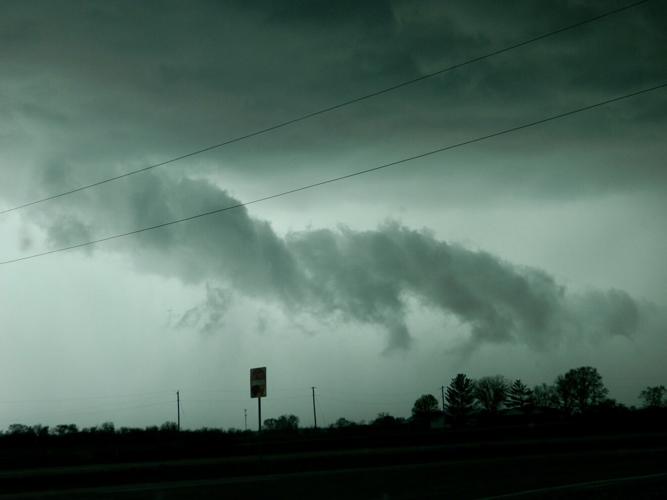
One tornado was reported in Lee County. The category EF2 tornado first touched down northwest of Houghton and started carving a 27-mile path, from 4:25-5:04 p.m., that ended south of Yarmouth in Des Moines County.
The NWS reports the worst damage occurred at a farmstead north of New London in Henry County, where the roof was removed from a brick house, one wall collapsed and the garage was destroyed.
“Numerous out buildings were also destroyed at nearby farmsteads,” the report states.
The maximum wind was reported at 130 miles per hour for this tornado. Damage was reported in both Lee County and Des Moines County as well after the storm.
Farther north, an EF1 tornado was reported northwest of Cedar Rapids near the towns of Quasqueton and Winthrop. That tornado had top winds of 110 mph and the path went for about 4.3 miles. It uprooted several trees, damaged at least one farm building and overturned a semi along Highway 20.
The National Weather Service also had a survey team investigate in Aledo, Illinois, and found damage there was due to straight-line winds.
Keokuk saw a brief thunderstorm on Tuesday and got about .44 inches of rain that day. Rain totals climbed going north, with Burlington seeing 1.84 inches from the storm.
The forecast as of Friday says there may be showers on Tuesday, with a chance for scattered thunderstorms all next weekend.


